|
Exocarpos sparteus |
Exocarpos sparteus |
.JPG) |
.jpg) |
|
Description: Fruit |
Description: Early fruit |
| Location:Coonalpyn,
South Australia |
Location:Vokes Corner, Anne Beadell Highway, South Australia |
| GPS
Coordinates:35°33.389S 139°47.132E |
GPS
Coordinates:28°33.339S 130°20.735E |
|
Date of photo:16
January 2012 |
Date of photo:10 August 2012 |
| Field
No.:1013 |
Field No.:1185 |
| |
|
|
Exocarpos sparteus |
Exocarpos sparteus |
.JPG) |
1.JPG) |
|
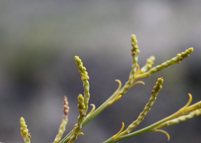
Description: Flower (2mm) |
Description: Fruit with curious ant |
| Location:Coonalpyn,
South Australia |
Location:Coonalpyn,
South Australia |
| GPS
Coordinates:35°33.389S 139°47.132E |
GPS
Coordinates:35°33.389S 139°47.132E |
|
Date of photo:16
January 2012 |
Date of photo:16
January 2012 |
| Field
No.:1013 |
Field
No.:1013 |
| |
|
|
Exocarpos sparteus |
Exocarpos sparteus |
 |
.jpg) |
|
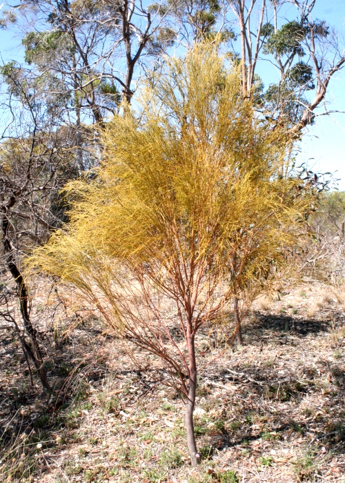
Description: Tree |
Description: Tree |
| Location:Coonalpyn,
South Australia |
Location:Vokes Corner, Anne Beadell Highway,South Australia |
| GPS
Coordinates:35°33.389S 139°47.132E |
GPS
Coordinates:28°33.339S 130°20.735E |
|
Date of photo:16
January 2012 |
Date of photo:10 August 2012 |
|
Field No.:1013 |
Field No.:1185 |
| |
|
|
Exocarpos sparteus |
Exocarpos sparteus |
.JPG) |
.JPG) |
|
Description: Immature fruit |
Description: Immature fruit |
|
Location:Flinders Highway, Streaky Bay, South Australia |
Location:Flinders Highway, Streaky Bay, South Australia |
|
GPS
Coordinates:32°51.443S 134°18.341E |
GPS
Coordinates:32°51.443S 134°18.341E |
|
Date of photo:17 November 2014 |
Date of photo:17 November 2014 |
|
Field No.:2943 |
Field No.:2943 |
|
|
|
|
Exocarpos
sparteus |
Exocarpos sparteus |
%20FN%202632%20%20(17).JPG) |
%20FN%202632%20%20(8).JPG) |
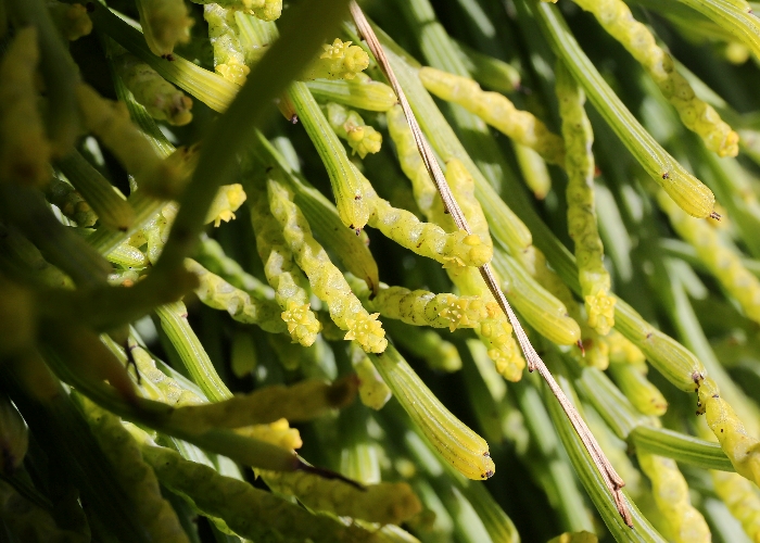
| Description: Flower |
Description: Inflorescence |
| Location:9 Mile Beach,
Esperance, Western Australia |
Location:9 Mile Beach,
Esperance, Western Australia |
|
GPS coordinates:33˚52.960S
121˚45.241E |
GPS coordinates:33˚52.960S
121˚45.241E |
| Date of photo:11 July 2014 |
Date of photo:11 July 2014 |
| Field No.:2632 |
Field No.:2632 |
| |
|
|
Exocarpos
sparteus |
Exocarpos sparteus |
%20FN%202632%20%20(3).JPG) |
%20FN%202632%20%20(2).JPG) |
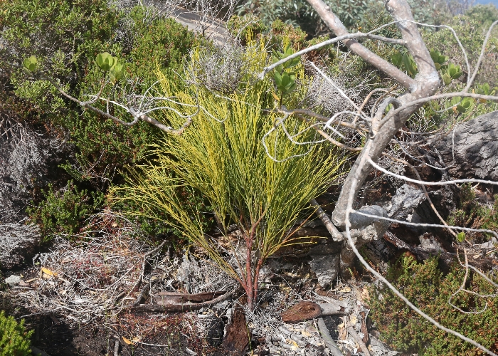
| Description: Plant showing
thick branchlets |
Description: Plant in coastal habitat |
| Location:9 Mile Beach,
Esperance, Western Australia |
Location:9 Mile Beach,
Esperance, Western Australia |
|
GPS coordinates:33˚52.960S
121˚45.241E |
GPS coordinates:33˚52.960S
121˚45.241E |
| Date of photo:11 July 2014 |
Date of photo:11 July 2014 |
| Field No.:2632 |
Field No.:2632 |
|
|
|
|
Exocarpos
sparteus |
Exocarpos sparteus |
 |
 |
| Description: Plant showing
flowers |
Description: Flowers and leaves |
| Location:Prevelly Beach, Western Australia |
Location:Stirling Ranges, Western Australia |
|
GPS coordinates:33˚58.2910S,
114°59.2380E |
GPS coordinates:34˚30.7200S,
118°02.4210E |
| Date of photo:18 August 2016 |
Date of photo:22 August 2016 |
| Field No.:5542 |
Field No.:4429 |
|
|
|
|
Exocarpos
sparteus |
Exocarpos sparteus |
 |
 |
| Description: Plant in habitat |
Description: Tree on
roadside |
| Location:Bald Rock, Frenchman's
Bay, Albany, Western Australia |
Location:Stirling Ranges, Western Australia |
|
GPS coordinates:35˚05.9330S,
117°58.0540E |
GPS coordinates:34˚30.7200S,
118°02.4210E |
| Date of photo:20 August 2016 |
Date of photo:22 August 2016 |
| Field No.:5585 |
Field No.:4429 |
|
|
|
|
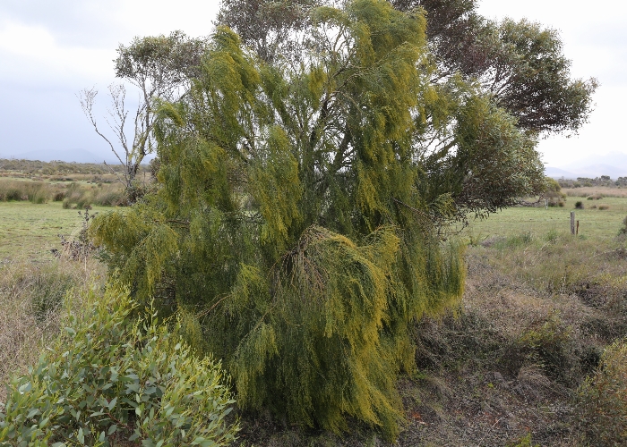
Exocarpos
sparteus |
Exocarpos sparteus |
.JPG) |
.JPG) |
| Description: Early fruit |
Description: Tree |
| Location:Frank
Hann National Park, Western Australia |
Location:Frank
Hann National Park, Western Australia |
|
GPS coordinates:32˚56.9720S,
120°20.0460E |
GPS coordinates:32˚56.9720S,
120°20.0460E |
| Date of photo:7 October 2018 |
Date of photo:7 October 2018 |
| Field No.:7132 |
Field No.:7132 |
|
|
|
|
|
|
|
|
|
